The largest constraint on the mission itself is that the satellite must be capable of communicating with the ground station on the roof of W.R.Woolrich Laboratories on the University of Texas campus for at least 60% of the flight. In addition to this constraint there are various other constraints placed on the mission by the FAA.
In order to determine a specific launch sight, the previous group used the angles in the following diagram, taking into account the fact that the ground station antenna has a field of vision which begins at roughly 15° above the horizon.
Figure 7.2.1: Launch Radius Determination [Wang]
By studying the geometry demonstrated in the figure above and considering the burst altitude of the balloon, the previous group determined that the launch site must lie within the circle seen on the map below.
Figure 7.2.2: Possible Launch Sites Must Be Inside This Circle [Wang]
In addition to being within this circle, the launch site must also meet all FAA regulations, including, being far enough from a congested area of a town to allow the balloon to reach at least 1000ft before crossing into that area [FAA Regulations].
Other considerations, such as weather and the cross winds at various altitudes, must be taken into account. The weather consideration, however, affects the launch date more than the launch location and must be considered nearer to our projected launch date of May 25, 2004. As the projected launch date approaches it will also be important to consider the winds that the satellite will experience during both its ascent and descent. These winds will greatly affect the location of the launch, and more importantly, the recovery. Luckily there is free software available, called Balloon Track, which will predict the approximate landing location of the satellite to within 15-20 miles based on jet stream data collected daily by the national weather service. If the balloon had been launched on May 5, 2004, from Buda, Texas (the origin on the polar plot), Balloon Track predicted that the trajectory would be that seen in the figure below.
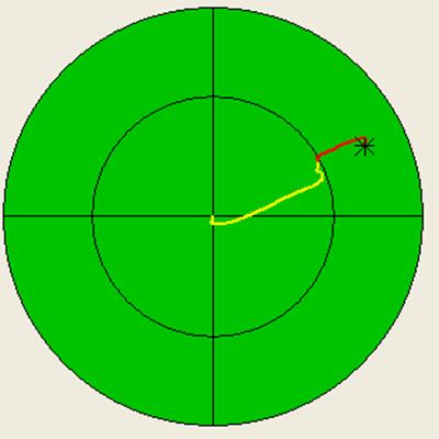
Figure 7.2.3: Balloon Track Prediction for a Balloon Launch
From Buda, Texas on May 5, 2004
By this prediction, BalloonSat would travel 65miles with a heading of 65°North of East before returning to the Earth. Buda, Texas was chosen as the preliminary launch site because the town itself is located within the circle drawn on the map in Figure 7.2.2. In addition, after several trials using the Balloon Track software with Buda as the starting point the predictions never showed BalloonSat crossing into a heavily populated area. Nearer the proposed launch date, this software will be used to determine the exact launch location that will prevent the satellite from landing in a heavily populated area, thus reducing the risk of harm to both the equipment and to other people.
In addition to considering the affect of the wind on the balloon, due to FAA regulations the weather must also be taken into consideration. The FAA requires that, on the day of the launch, the visibility must be at least 5 miles at any altitude below 60,000ft [FAA Regulations]. This will greatly affect the launch date since the weather in central Texas is unpredictable, at best.
Initially, the planned launch date was April 17, 2004. On this date there was an attempt to launch BalloonSat.
Prior to the launch date, four teams had been chosen to conduct the launch, tracking, and recovery of BalloonSat. One team was chosen to operate the tracking station at W. R. Woolrich Laboratories (WRW) and was headed by Tom Campbell. The remaining three teams, the chase teams, headed by Greg Holt and consisting of the BalloonSat team and various other FASTRAC personnel and volunteers, were chosen to travel to the launch location, perform final tests of the FASTRAC and BalloonSat equipment, launch the balloon, and finally, with the help of the ground station team, track and recover the balloon.
On the day of the launch, the teams met in the Satellite Design Lab (SDL) in WRW at approximately 5:00a.m. From this point all the FASTRAC and BalloonSat equipment was tested, then packed into the vehicles which would transport the equipment and the three chase teams to the launch location which had been previously determined by Tena Wang. The location chosen was Dahlstrom Middle School in Buda, Texas, which had a large field adjacent to it that would used as the launch site.
Upon arrival at the school, at approximately 6:30a.m., the equipment was unpacked and laid out on tarps, flat on the ground, in the previously described balloon unit configuration as seen in the photo below.
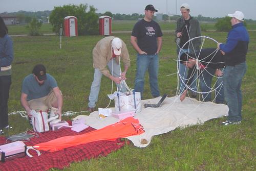
Figure 7.3.1: Photo of BalloonSat Laid Out on Tarps on 4/17/2004
Once BalloonSat was laid out in the proper configuration, with the balloon upwind to allow for an easier transition from BalloonSat’s position on the ground to an upright position, the testing of the components began.
First, the FASTRAC components were tested by Nathan Meyer, seen below, to ensure that they were working properly.
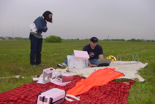
Figure 7.3.2: Nathan Testing the FASTRAC Components Before Launch
Some of the FASTRAC equipment encountered problems communicating with the tracking station, so while Nathan attempted to correct the problems, Mike Newton and Greg Holt began testing the beacon equipment, as seen below.
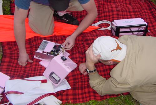
Figure 7.3.3: Mike Newton and Greg Holt Testing the Beacon Equipment
Testing of the beacon equipment included, powering up the beacon, sending a test DTMF signal to the radio, and waiting for the tracking station to confirm that the beacon was transmitting its position. Even though all of the FASTRAC and beacon equipment had function properly in the SDL just hours before, many problems were encountered once the equipment was actually tested in the field. Since the operation of the FASTRAC equipment was not the responsibility of the BalloonSat team, we concentrated our efforts on diagnosing and correcting the problems with the beacon. Upon further inspection, Lee Cross determined that the beacons radio had malfunctioned and burned out preventing the beacon from transmitting or receiving any information. This problem meant that BalloonSat would not be launched as planned. However, the team soon made the concession that BalloonSat would not have been launched regardless of the equipment problems. The weather conditions at the launch site did not meet the FAA requirement of 5 mile visibility, as can be easily seen in the following photo.
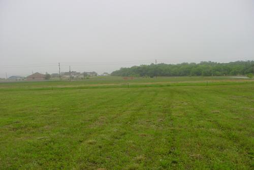
Figure 7.3.4: Photo of the Poor Weather Conditions on the
By 9:00a.m., it was obvious that neither the weather nor the equipment was going to allow BalloonSat to be launched on this day. The team decided to abandon the launch in favor of a later date.
With the end of the semester approaching, the next launch attempt was scheduled for May 23, 2004, after finals, to ensure that all interested parties could participate. Work on the defective beacon is completed and ready for a new launch date.
There is no future work. We have accomplished all the FASTRAC requirements and the only thing left to do is to perform the launch.
 |
|
